
File:תמונת לווין-הים התיכון.JPG
Non sono disponibili versioni a risoluzione più elevata.
תמונת_לווין-הים_התיכון.JPG (529 × 269 pixel, dimensione del file: 33 KB, tipo MIME: image/jpeg)
| Questo file e la sua pagina di descrizione (discussione · modifica) si trovano su Wikimedia Commons (?) |
Dettagli
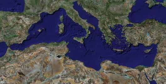
| Descrizione | Satellite caption of the Mediterranean Sea |
| Data | |
| Fonte | Screenshot from NASA World Wind (retouched) |
| Autore | of the modification : Eric Gaba (RonenY) |
| Licenza (Riusare questo file) |
All rights released |
| Altre versioni |
blank with State borders : Image:Mediterranean_Sea_political_map-blank.svg ; with caption in English : Image:Mediterranean_Sea_political_map-en.svg ; with caption in French : Image:Mediterranean_Sea_political_map-fr.svg |
Licenza
| This image is in the public domain because it is a screenshot from NASA’s globe software World Wind using a public domain layer, such as Blue Marble, MODIS, Landsat, SRTM, USGS or GLOBE.
|
 |
| This work was previously under Public Domain, or a Free License. It has been digitally enhanced and/or modified. This derivative work has been (or is hereby) released into the public domain by its author, Sting at the French Wikipedia project. This applies worldwide. In some countries this is not legally possible; if so:
|
Licenza
| This image is in the public domain because it is a screenshot from NASA’s globe software World Wind using a public domain layer, such as Blue Marble, MODIS, Landsat, SRTM, USGS or GLOBE.
|
|
Cronologia del file
Fare clic su un gruppo data/ora per vedere il file come si presentava nel momento indicato.
| Data/Ora | Miniatura | Dimensioni | Utente | Commento | |
|---|---|---|---|---|---|
| attuale | 04:09, 30 lug 2007 | | 529 × 269 (33 KB) | RonenY~commonswiki | == Summary == {{Information |Description=Satellite caption of the Mediterranean Sea |Source=Screenshot from NASA World Wind (retouched) |Date=30 June 2007 |Author=of the modification : Eric Gaba (RonenY) |Permissi |
Voci che usano questa immagine
La seguente pagina usa questo file:
Utilizzo globale del file
Anche i seguenti wiki usano questo file:
- Usato nelle seguenti pagine di he.wikipedia.org: